Real store listing · independent assessment pending.

3.0 ★2 ratings
—Downloads
4+Age rating
62 MBApp size
FreeIn-app purchases
About this app
防災情報「全国避難所ガイド」Ver.6
【Ver6の新機能リスト】 ・ハザードマップ判定に「高潮浸水想定区域」を追加しました。 ・マップ画面のハザードメニューに「雨雲レーダー」を追加しました。
・海上警報および海の安全情報を表示します。 ・防災情報にAIのアドバイスを表示します。 ・国民保護情報の発表に連動して、国民保護避難施設を表示します。 ・平常時には、災害用避難所・避難場所と国民保護避難施設の切り替え表示ができます。
・トップ画面に現在地の災害リスク情報を表示します。 ・避難所混雑状況が表示できるようになりました。 ・防災情報は現在地以外に最大3ヵ所の情報をプッシュ通知します。 ・土砂災害警戒区域、洪水浸水想定区域、津波浸水想定区域のハザードマップを表示します。 ・ユーザーインターフェースを大幅に改善しました。
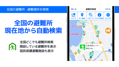
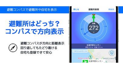
防災情報「全国避難所ガイド」は、現在地周辺の避難所・避難場所を自動検索し、各種ハザードマップを表示するほか、現在地の防災情報をプッシュ通知でお知らせするスマートフォン向け防災情報アプリです。 全国の自治体が定めた災害時の避難所や、避難場所を15万件以上収録し日々更新しています。 現在地周辺の避難所・避難場所を自動検索して、施設までのルート案内や避難コンパスで災害時の避難行動を支援します。 現在地と最大3ヵ所の地域を登録することで、避難情報や気象情報など各種防災情報をプッシュ通知でお知らせします。 安否登録や安否確認機能を利用することで、災害時に備えての避難訓練や、災害時における家族の安否確認に役立ちます。
全国避難所ガイド サポートサイト https://www.hinanjyo.jp/
【収録データ】 ・全国避難所データベース 17万件以上収録(データベースは随時更新しています) ・全国の避難所(指定避難所)、避難場所(指定緊急避難場所)、帰宅困難者一時滞在施設、津波避難施設、災害医療機関、給水拠点など…
Preview
Real screenshots from the store listing.




Independent evidence report
Evidence and review signals
This is where the page changes from an app-store listing into an evidence report: findings, important reviews, pricing and a dated history.
What we measured
Each line is a measurement published as a measurement, never a verdict.
Each line is a measurement, published as a measurement. Where we have not looked, the line says so rather than reading as a zero.
Developer replies to reviews
Not assessed
Fewer than 50 reviews scanned — too few to state a rate
Price in the store description
States no price and billing period
Cancelling, in the store description
Does not say how to cancel
Themes reported by reviewers
Not assessed
This app's reviews have not been assessed yet
Five-star share of ratings
Under 65% five-star
Arithmetic on the stores' own published rating counts. It says nothing about why the ratings fall where they do.
In the package we scanned
No package has been scanned for this app, so nothing is published about what it ships. That is an absence of evidence about the app, not a finding about it.
Graded bands · predicate set 1.4 · how these are measured
What the analysis found
App-specific findings, grouped by what each one rests on. How they are graded lives on its own page.
No review themes cleared the reporting threshold.
Assessment & version history
App changes and Appworthy events in one timeline.
What this app sells
Useful store-disclosed pricing, kept below the app listing.
Business modelFree
Prices and terms as disclosed by the store listing.